Quick answer: a hydrogeological survey report tells you four things before you spend on drilling: where to drill, how deep to go, how much water to expect and what could go wrong, such as salty water or loose ground. Every other page in the report supports those four answers. This guide shows you where to find each one, using real survey profiles from our 2026 jobs.
You may also hear it called a borehole survey report, a hydrological survey report or simply “the HSR”. In Kenya it is the document you attach to your permit application to the Water Resources Authority, so it has to be done properly.
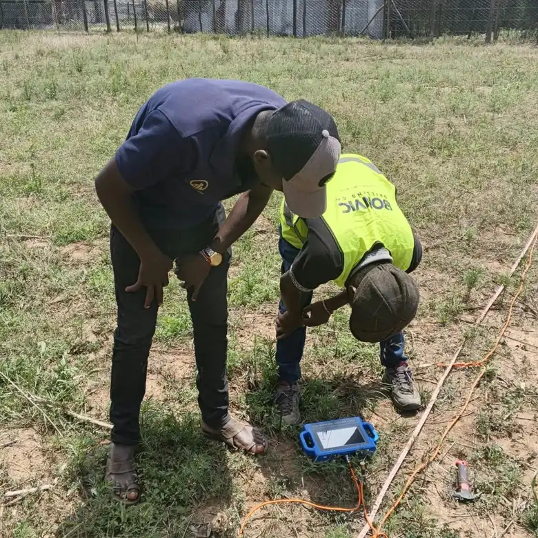
What Goes Into a Hydrogeological Survey Report
A good report follows the same order every time. Here is what each section is for.
1. Site details
The location of the land, the county and sub county, the GPS coordinates and often the title or plot number. Check these carefully. A report with the wrong plot details can delay your permit.
2. Geology and hydrogeology of the area
This section describes the rocks under your land and what nearby boreholes have found: their depths, their yields and their water quality. It explains why a depth is being recommended. The British Geological Survey’s hydrogeology of Kenya shows how much this varies from region to region.
3. The geophysical survey
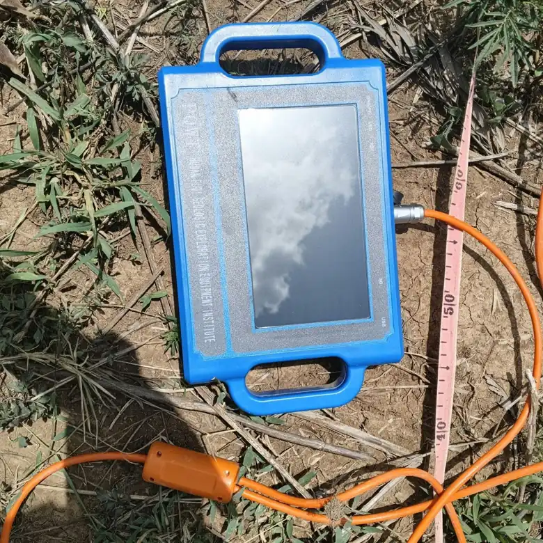
Here the hydrogeologist explains how the ground was measured: which instrument was used, how many profile lines were run and how far apart the readings were taken. Instruments like the one below take readings at fixed points along a line laid out across your land.
4. The profile charts
This is the part most clients skip, and it is the part worth understanding. Each chart is a slice through the ground along one survey line.
- Across the top: the numbered measuring points along the line on your land.
- Down the side: depth below the surface in metres. Negative numbers simply mean “below ground”.
- The colours: the strength of the measured signal at each point and depth. The hydrogeologist looks for zones that stand out from the surrounding rock and continue with depth, which can indicate fractured or water bearing layers.
- The marked column: where the report recommends drilling.
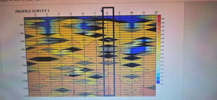
Deep aquifers need deep profiles. The chart below runs to 500 metres, which is the kind of survey needed where water sits far down, as in parts of Nairobi and Machakos.
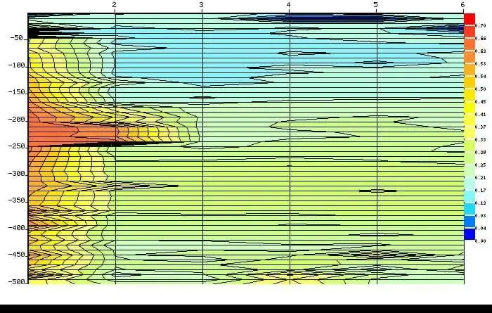
You do not need to interpret the colours yourself. What matters is that the report shows the data and explains, in plain words, why the chosen point was picked over the others.
5. Recommendations
This is the page to read twice. It should give you:
- The recommended drilling point, with GPS coordinates, and ideally a second option
- The recommended depth
- The anticipated yield, usually in cubic metres per hour
- The recommended drilling method and borehole design, including casing and screens
- Any water quality risks, such as fluoride or salinity
6. Signature and registration
The report must be prepared or reviewed by a registered hydrogeologist, whose name and registration number appear on it. If there is no registration number, ask why.
What the Numbers Mean for You
| Report item | What it means for you |
|---|---|
| Recommended depth | Your drilling budget. Multiply the depth by the per metre rate; see our borehole drilling cost in Kenya guide. |
| Anticipated yield | How much water you can use. 1 cubic metre per hour is 1,000 litres for every hour of pumping. |
| Drilling method | Air drilling for hard rock; mud rotary for loose or collapsing ground, which costs more per metre. |
| Casing design | How much plain casing and screen goes in, and where. |
| Water quality notes | Whether you should plan for treatment after drilling. |
Two Real Report Examples from 2026
Machakos County, 320 metres. A survey report we revised for a client in Machakos recommended drilling to 320 metres, with an anticipated yield of 1 to 4 cubic metres per hour. It was prepared by a hydrogeologist and reviewed by a registered hydrogeologist. At that depth the recommended depth drives most of the budget, which is why the report comes before any drilling quote.
Kilifi County, 130 metres by mud rotary. A coastal survey near Malindi recommended mud rotary drilling to 130 metres at a specific profile line, with a 216 mm hole and 153 mm casing made up of 80 metres of plain casing and 50 metres of screen, for an anticipated 2 to 3 cubic metres per hour for domestic use. The method was chosen because loose coastal ground would collapse during air drilling. Read more in air vs mud drilling in Kenya.
Red Flags in a Survey Report
- No registration number or signature from a hydrogeologist
- No GPS coordinates for the drilling point
- No profile charts or data, only a depth and a yield
- A recommended depth with no explanation
- Details that clearly belong to a different plot
- A report written without anyone visiting your land
A report like this puts the most expensive part of your project at risk. It is cheaper to redo the survey than to drill in the wrong place.
The Yield Is an Estimate Until Test Pumping
A survey reads the ground indirectly, so the yield in the report is an estimate. The real yield is measured after drilling by test pumping, and that result is what your pump is sized from. See our borehole test pumping services. Research on Kenyan aquifers, such as this study in the Hydrogeology Journal, shows how much yields can vary even over short distances.
What Happens After You Get the Report
- Apply for permits. The report goes with your WRA application, as required under the Water Act 2016. See do you need permits to drill a borehole in Kenya.
- Get a drilling quote based on the recommended depth and method.
- Drill at the marked point, logging the rock and water strikes as the rig goes down.
- Test pump and analyse the water, including fluoride, which the World Health Organization recommends keeping below 1.5 mg per litre in drinking water.
Planning to buy land first? A survey before you pay can save you from a plot with no reliable water. See hydrogeological survey before buying land in Kenya.
Frequently Asked Questions
Is a hydrological survey report the same as a hydrogeological survey report?
For boreholes, yes. Strictly, hydrological refers to surface water, but in Kenya both names are used for the borehole survey report that WRA asks for.
Who can sign a hydrogeological survey report?
A registered hydrogeologist. Their name and registration number should appear on the report.
Can I use my neighbour’s survey report?
No. The report is for a specific plot and drilling point, and water conditions can change a lot over short distances.
Does a survey report guarantee water?
No survey can guarantee water, but a properly done report greatly improves your chances and tells you the depth and yield to expect.
How much does a hydrogeological survey cost?
With Bonvic Drilling, a full survey with a signed report costs KES 50,000. See our hydrogeological survey page for what is included.
Book a hydrogeological survey for KES 50,000, or if you already have a survey report, WhatsApp it with your location to 0727 666 444 and we will quote the drilling.